Into the valley of the March Burn
cc-by-sa/2.0 – © Oliver Dixon – geograph.org.uk/p/6466308
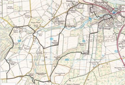
This walk takes in some of the most scenic areas of the quiet countryside in the valley of the March Burn to the south-west of Riding Mill.
7 miles/11 kilometres, 900 feet/270 metres of ascent. Paths and quiet roads. Sometimes muddy.
- Leave the Old Playground heading west along Church Lane and up the hill towards Long Rigg. Where the hill ends, take the public footpath signposted Broomleyfell on the left heading south.
- The lane ends at a stile into fields; here turn left and head steeply uphill towards High Plains.
- At the hill top, turn right taking the footpath running west into the woods beyond the farmhouse. The level path follows the contour through the wood to a stile with concrete steps across the Parish boundary.
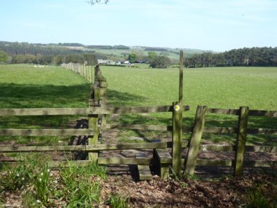
- Continue onto Eastwood house Common with extensive views over Slaley Vale and Hexhamshire, following the way-markers until a minor road is reached. Almost directly ahead is a bridle path heading into the narrow valley of the March Burn. Keep straight ahead once a gate is reached and follow a zig-zag track to a bridge over the burn near the confluence of two streams. Cross the bridge and follow an easier track uphill to the Slaley road.
- Turn left along the road for a short distance, then take the Wooley road until a public footpath heads northwards through fields towards Todburn Steel farm. Follow the yellow way-markers, keeping the farm buildings to your right, and over a ladder stile into the southern fringe of Dipton Wood. Here are some fine old oak trees bordering the forest, inhabited in early summer by birds such as the uncommon Pied Flycatcher alongside more common species such as Woodcock and Jay. The path heads down to the stream and then through beech woods to join a minor road west of Dipton House.
- Follow the road downhill and at the junction with the Slaley road turn right, downhill to the next junction where you take the left fork sign-posted Healey. Soon the March Burn is crossed by a ford normally dry in summer which can flood, and is avoided by using the adjacent footbridge. The quiet lane ahead is deeply incised into the hillside and features a wide variety of wild flowers. The next right of way is a footpath on the left signposted Riding Lea; follow this to Red Hemmels and then downhill into pastures to cross the March Burn for the third time below Shepherd’s Dene. One last climb follows through mixed woodland fringed by ancient hedgerow trees, before emerging onto the road west of Beauclerc.
- The route then heads back to Riding Mill. To avoid the main road, at the junction with the A695 turn right up The Nick and follow Sandy Lane anti-clockwise until a narrow way-marked path at a yellow hydrant sign leads down to the weir and then right onto Marchburn Lane.
- Turning left onto Millfield Road, the footpath by the Parish Hall leads to the sixth and final crossing of the March Burn by the old stone bridge, and back to the walk’s starting point.