Walk 1 – Four miles.
- From the Old Playground, turn left and west along Church Lane, past the school, continuing straight ahead up the steep bank to Long Rigg. As the road levels out, turn left (the route is waymarked by a finger post but you will have to look back to see it). Keep following this track to its conclusion.
- At the end of Church Lane track, turn left and head up hill crossing another stile into an open field.
- Head straight up this field crossing another stile into an enclosed track and continue straight uphill until the gradient eases, with High Plains Equestrian Centre on the right.
- Go through a wicket gate and turn right, passing in front of High Plains farm house, heading slightly left across the hardstanding area to a substantial track (the middle one of 3) which crosses a small stream and concludes at a 5 bar gate.
- Turn right over a stile just before the gate into the wood and follow the path ahead, sweeping around to the left and keeping the field boundary dry stone wall to the left.
- Once over the remains of a dry stone wall after a couple of hundred yards, the path becomes a more substantial track.
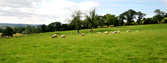
- Continue ahead through the wood until the track forks and follow the right hand fork downhill, emerging from the trees at the top of two fields.
- Turn right down between the fields keeping the fence on your right and hedge to the left (often wet).
Over a stile, keep the fence on your left then continue downhill heading slightly leftwards to avoid the gulley. - Continue ahead in roughly the same direction for a further 200 yards and when the gradient steepens once again and you will see the Blue Bridge ahead of you.
- Cross the bridge, over a stile and follow the steep rough track ahead up through trees crossing another stile alongside a 5 bar gate near the top of the track to reach the Slaley road by Riding Lea Cottages on the right with a post box mounted int he wall.
- Turning right on to the road, follow this past Beauclerc and keep right, down to the main road at the western edge of the village.
- Cross and follow the main road down in to the village, crossing back by the Wellington Pub, turning right up the small lane opposite the pub car park entrance, over the Pack horse bridges and back to the Old Playground.
To extend walk 1 to six miles:
Following the Church Lane track after leaving Long Rigg (point 1), instead of walking to the end of the track, take the first path on the left (uphill), through an opening with a gate and stile alongside just over a hundred yards before the end of the track.
- Follow this path up the fields, over three stiles, keeping the hedge on the right and ignoring the path leaving to the right, until it emerges onto the Broomley Pit House Road via a ladder stile.
- Turn right once over the stile into the entrance to High Plains and then immediately left crossing another stile and into a field.
- Cross the field keeping the wall on your left over a couple of stiles and into a wood.
- Follow the path straight on through the wood, keeping the stone wall to your left and ignoring criss crossing forestry tracks and unofficial paths, crossing a stone wall via a stile, finally emerging onto a tarmac road.
- Turn right following the road for about 1/4 mile until reaching a marked footpath on the right.
- Cross a stile from the road onto open heathland. The path heads down to the left (indistinct) through the gorse for a couple of hundred yards before heading right (waymarked) before a wire fence, along a more distinct path.
- Keeping the field boundary to your left, the path soon drifts right, by a low way marker. Continue through gorse and heather, until reaching a stile over a stone wall into the wood directly ahead.
- Cross the stile and head down with a stone wall on the left for 30 yards, then on reaching a track turn right and follow this track through the wood straight ahead, ignoring the more distinct track which heads off half right almost immediately.
- On reaching a fork in the track after about 300 yards, double back and downhill, now following the track to the Blue Bridge (point 9 – point 12 above) and back to the village.
Comments are closed.