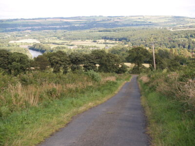
Track near Riding Hills
cc-by-sa/2.0 – © Bill Boaden – geograph.org.uk/p/5401304
A linear walk to Corbridge via Beauclerc, Riding Hills and Prospect Hill
Length: 3.5 miles / 5.5 km
- Leave the Old Playground, crossing Church Lane, down the path and over the Packhorse Bridge keeping the church on your left.
- Continue to the main road, crossing by the Wellington Inn, turn right and follow the road uphill out of the village.
- At the end of the houses, the road to Slaley is uphill to your left. Cross and follow this road to the small hamlet of Beauclerc. Watch out for a track on your right leading to Riding Hills (Footpath 508/010). Follow the path through a 5-bar gate and straight ahead uphill along the field edge, keeping the fence to your right.
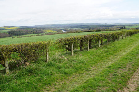
- Panoramic views soon open up down the Tyne Valley, contrasting the nearby woods and fields against a backdrop of urban Newcastle. Keep the field boundary to your right and pass through a gate before Riding Hills, turn left and head through a further gate onto the road (please note: the footpath has recently been diverted and no longer passes through the courtyard of the properties at Riding Hills).
- Emerging onto the road, turn left and follow it uphill. A road to your right is soon reached. Turn right here and follow this road uphill along a ridge of high land, again with stunning views.
- When reaching a crossroads, take the road to the right, signposted to Corbridge. The road swoops downhill past a long-abandoned quarry and zig-zags towards the A695; in a couple of places you can take a footpath shortcut to hasten your descent (lookout for a stone wall stile on your right).
- Once at the A695, take the B-road downhill towards Corbridge Station and the village centre.